Friday, June 7, 2013

Chase Log - 5-28-2013 Bennington, KS Tornadoes

What a day! After the incredible chaser convergence and brief views of 2 tornadoes the day before in north-central KS, we headed back down to Salina for the night. Met Brandon Sullivan, Brett Wright, and Gary Schmitt for lunch...and finally met Roger Hill there, as well. Models were pretty well in agreement in showing a small but significantly potent tornado threat just north of Salina, where an outflow boundary would intersect with a deepening low pressure center and southward extending dryline.

We left, activated a US Cellular data card, and sat just east of Salina for a while. As we were waiting, met up with Matt Phelps and ETT for a bit, then left as towers started to fire. Headed over to Abilene, and watched the dryline bubble. Finally, a cluster of updrafts fired and moved slowly to the northeast. We headed west towards it, stopping for 20 minutes or so to watch it organize. As we did, an incredible mammatus show appeared overhead!


By far the best mammatus I've ever seen...myself and Ellie just sat on the hood of the Jetta and watched it for a while. Then, as the core of the supercell started to organize rapidly, we blasted west to get a better view of the meso.

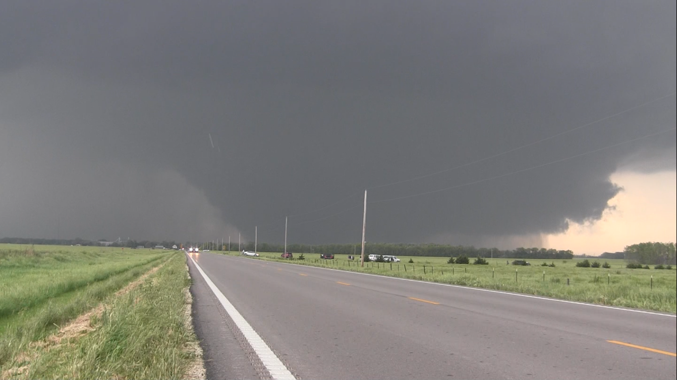
As we approached, a large wall cloud became apparent...


This wall cloud dropped a brief tornado as we approached it. We pulled over on the side of the road about  a mile or so west of Bennington, KS. What followed was the most amazing tornado I've ever witnessed...

The mesocyclone recycled, and a second wall cloud started to take shape to the northeast. Here's a radar shot with our position indicated by the white circle...GPS integrated into the radar software.


At this point, the storm stalled. Literally. No forward motion at all. At this point, it was obvious that it was just a matter of time until a big tornado was going to form. Rotation from the second wall cloud was unbelievably rapid.


The structure was incredible...look at the mid-level inflow bands wrapping around from the southeast into the wall cloud at the top-center of the picture! These feeder bands would eventually extend for miles south of the storm, injecting it with primed warm, moist air to feed on.

Several scuddy funnels started to drop from the wall cloud as tornadogenesis became imminent...


And then, a massive cone drops from the skies above.


The tornado partially wrapped itself in rain several times during the early stages of its' life cycle, all the while slowly growing into a monster.


Then, incredibly, the tornado emerged completely from the surrounding rain curtains, and entered what would be its' most photogenic phase.


The tornado then wedged out to over a mile wide, and became almost completely rain-wrapped. I swung east about a mile to get shots of the meso above...


We got a couple more good video shots while the tornado was over a mile wide.


The tornado eventually occluded and dissipated, deep in the rain curtains, after being on the ground for over 45 minutes! It was rated EF-4 due to wind speed measurements from the DOW. And, it was Ellie's first good Plains tornado!

UPDATE: Finished editing the video, here's the final work!


Wednesday, May 29, 2013

GoPro Timelapse Video of the Rozel, KS Tornadoes!


First chunk of footage is from the Ness City, KS tornadic supercell...we dropped that and headed down to the Rozel cell. My chase partner Jonathan Williamson put a GoPro on the hood, and this is what it saw...

Tuesday, May 28, 2013

Monster Wedge Tornado! - Bennington, KS, May 28, 2013

Got incredible footage of a photogenic, monster wedge tornado near Bennington KS today! Video is below! First 10 minutes are of the wall cloud developing and cycling...tornado touches down at 10:05.

Sunday, May 26, 2013

Incredible Rozel, KS Tornadoes! May 18, 2013

Pulled down 6 tornadoes over a 5 day chase trip last week, including 4 incredible close-range tornadoes near Rozel, KS. The first one of the day was the strongest, garnering an EF-4 rating.


As we came out of the rain curtains after core punching the storm from the north, a huge cone tornado appeared out of the mist, backlit by the sunset. 


We got closer, eventually watching a second tornado develop and rope out about a half mile in front of us.


We blasted back east after the second tornado had dissipated, and captured the third tornado of the day from 1/4 mile away! 


This third tornado was the most beautiful and photogenic tornado I've ever witnessed. It cycled through several different shapes, eventually re-forming as a rope tornado under a brilliant mammatus-filled sunset behind us. 

I'm still editing the video from this day, but it'll most likely be a week or two until I'm able to finish up. In the meantime, looks like there's solid chances of tornadoes in Kansas the next two days, with a dryline play in SW Oklahoma Wednesday to finish out my trip!

Saturday, October 13, 2012

First Texas Tornadoes!

Pulled down 2 tornadoes (a multiple vortex and weak rope) in west-central Texas last night...first Texas tornadoes ever! Structure on the supercell was unreal...huge bowl wall cloud just churning a couple hundred feet off the ground. Got video, won't be able to post until mid-week. Looks like a better setup today from maybe Elk City, OK through south-central Kansas...starting in Elk City this morning. Fall season is here in full force!

Saturday, July 28, 2012

2012 Season Summary

Last year, as I was finishing up the paperwork to join the Navy, I wondered if 2011 would be my last tornadoes for a while. It was a big risk, but a risk I was willing to take to reinvent my life and career. As it turned out, I didn't miss much.


I pulled 6 tornadoes in 2012 - not 20+ like 2011, but considering how slow the year was, I'm not complaining. 5 of those were on the biggest day of the year - April 14th, and all in NW OK. Much has been said of the epic footage that so many chasers got that day...for me, April 14th stands out as the best chase day of my career - not only because we saw an incredible multiple vortex tornado morph into a beautifully cut cone, but also because of the time schedule I was able to pull that chase off in - leaving Pensacola at 5 PM on Friday, driving through the night with only an hour of sleep caught in a Pizza Hut parking lot in Dallas, and then non-stop chasing/driving until I finally crashed at 1 AM Sunday.


The other tornado I saw was a quick drop on what was definitely the most disappointing day of the year - April 27th. It really was pure luck that we saw it...I just happened to be looking back to our northwest as we raced eastward to stay in the inordinately narrow warm sector.


Other highlights...Incredible supercells back to back days in MN that rode the warm fronts May 1st/2nd.


A freak IL boundary day where storms that looked terrible on radar spun up insane rotation and a lightning show for the ages.


A gorgeous LP supercell in North Texas with inflow winds so strong it created a dust storm. 


As far as goals I accomplished for the year...I really hit the books hard, working on improving my forecasting knowledge. It's paid off quite handsomely, but I still have a long way to go. Finally met Jonathan Williamson and Jennifer Brindley...a couple of great chasers/photographers, as well as some of the greatest people you'll ever meet. I also saw 2 tornadoes at once during daylight for the first time ever, as well as a cleanly cut, very large stoveipe - always wanted too see one of those. 


As for next year? Now that I'm settled into my job, I'll be able to take about a month off next spring, and dedicate it to chasing. I've never been able to say that before. And I'm insanely excited for it. This was the year to have scheduling/work conflicts - next year, the Plains are mine. Plus, I added a permanent chase partner to the mix...my wife, Ellie.


In short, estimated 14,000 miles chasing, including 2,470 on April 14th (personal record!), 6 tornadoes, and unless something pops up, that's a wrap on 2012!


Below are a couple shots I never got around to posting...I was out with Williamson on May 1st/2nd, and he had some great shots! These are from May 2nd.


The storm starting to get its' act together...note the inflow tail/developing wall cloud just left of center. 


A ground-scraping wall cloud with evident RFD cut sweeping in. 


Buoyant RFD creates an other-worldly gust front on the southern edge of the supercell. 

See you in 2013!